The Leader of Underwater Technology in China

   中文 | English  

Side Scan Sonar

Shark-S457M Multi-beam Side Scan Sonar

  • Description
  • Features
  • Specifications
  • Application
  • Download

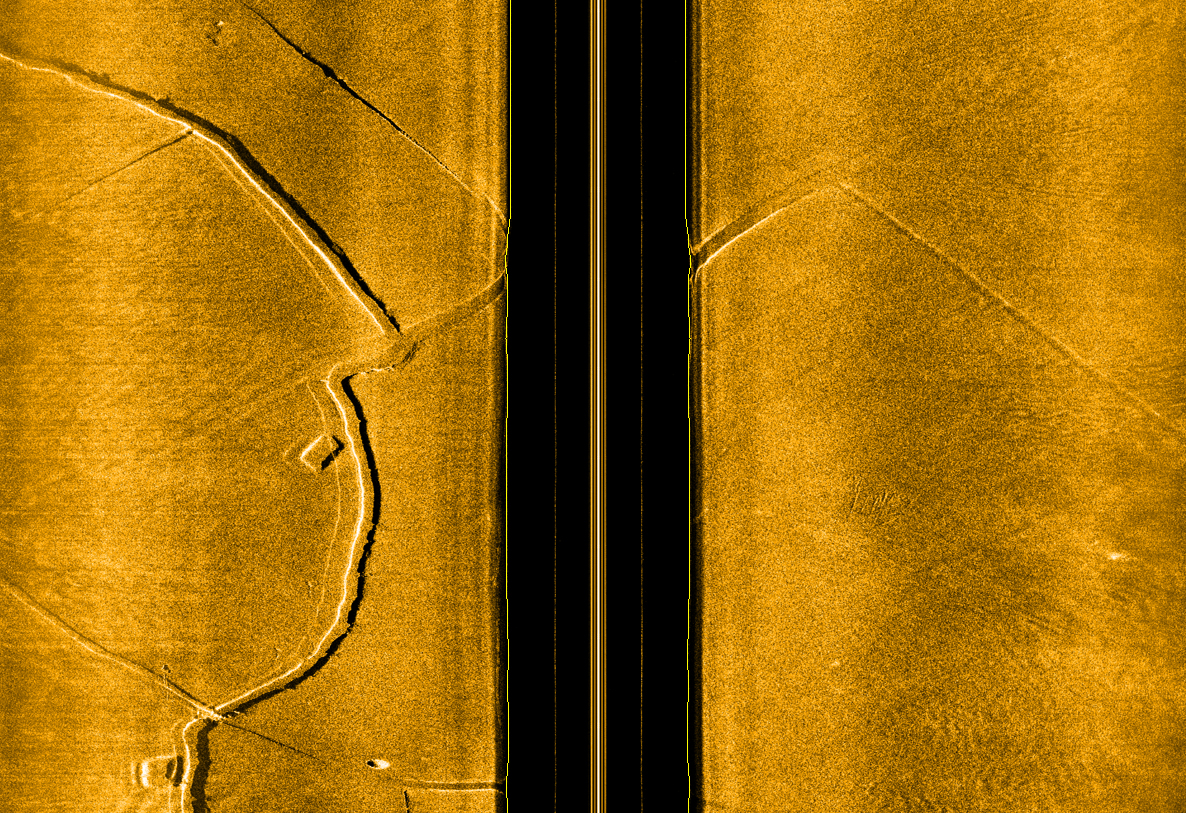
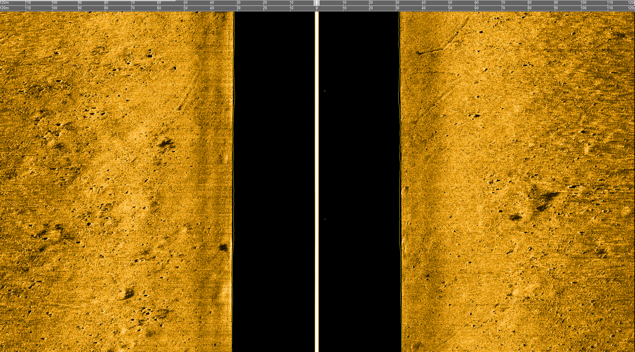
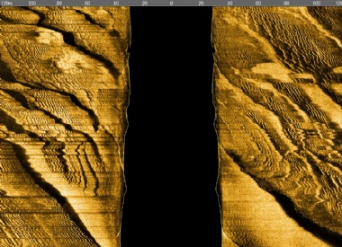
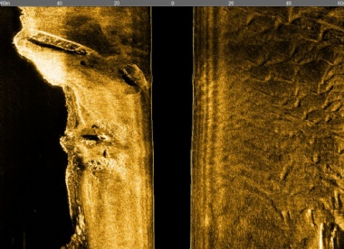
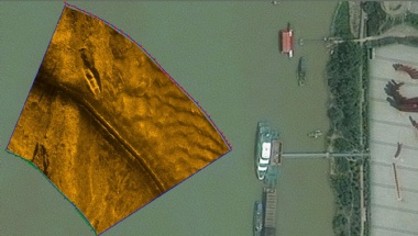
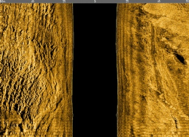
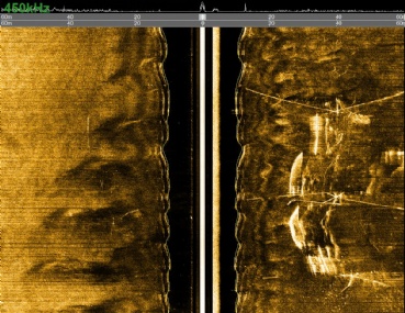
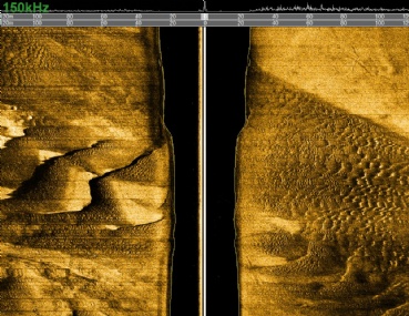
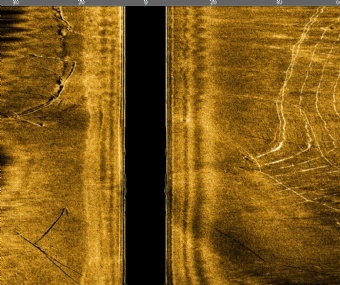
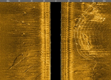
    The multi-beam side-scan sonar stands as the top-tier product in the side-scan sonar field. Using advanced dynamic focus technology, the Shark-S457M delivers significantly improved along-track resolution, making it ideal for mine clearance, emergency search and rescue, and small target detection. With an increased maximum operational speed of 12 knots, it greatly boosts survey efficiency. Additionally, in turbid waters or for wide-area scans, the Shark-S457M multi-beam side-scan sonar supports a low-speed, dual-frequency mode that can be switched in real-time, achieving an optimal balance between speed and resolution.


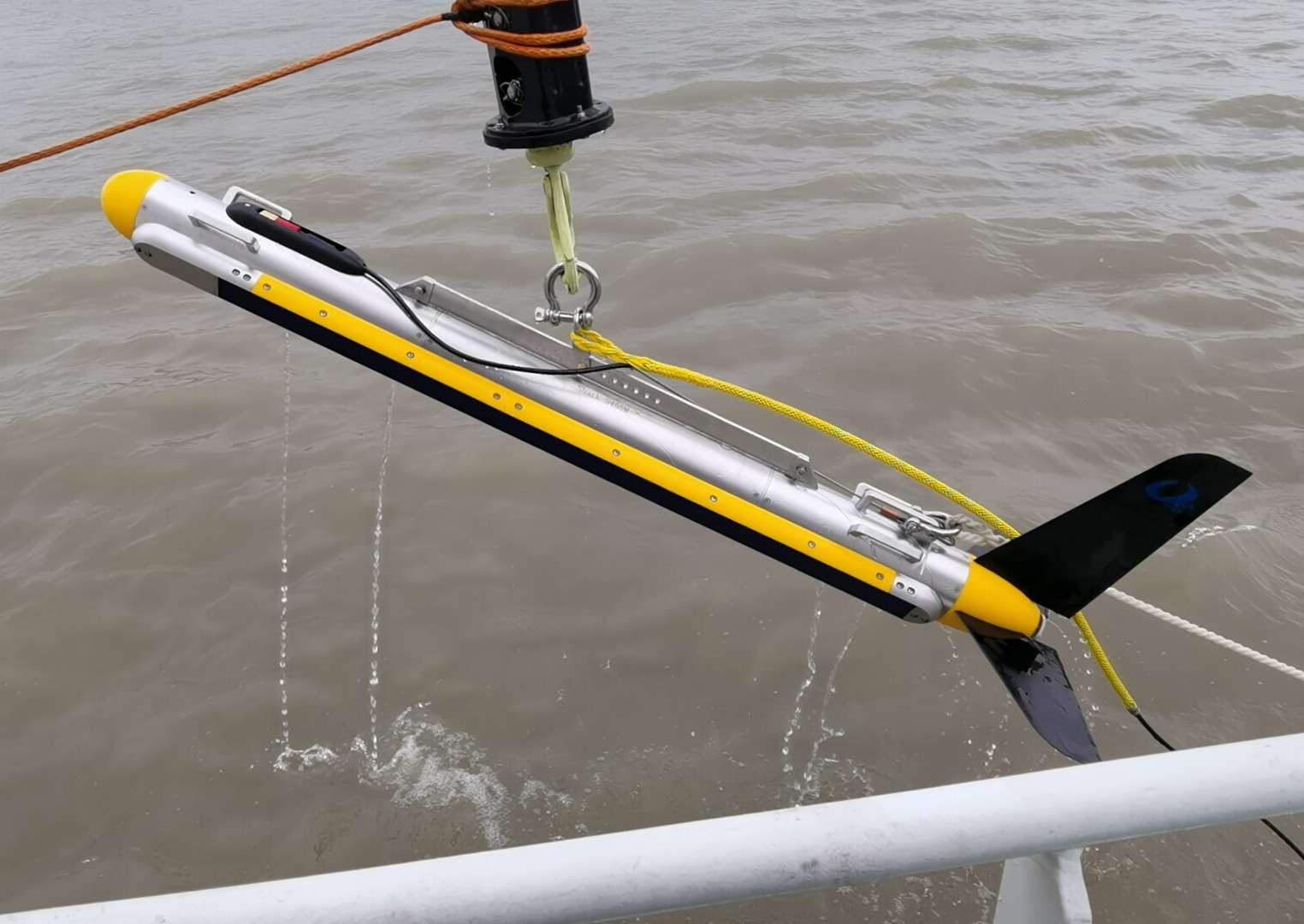
    The system’s core components include a pressure-resistant towfish, a high-strength Kevlar cable, a waterproof deck unit, and proprietary OTech sonar software. The towfish is available in a 66 kg stainless steel version or a 46 kg carbon fiber version and can be deployed in multiple ways, including towing, hull mounting, or side-mounting. It features a robust and durable structure. To enhance underwater safety, we included an overload protection pin on the towfish that breaks upon impact. Its hydrodynamic design ensures steady towing, and an optional depressor enables it to reach greater depths. The system has an ultra-low power consumption design and supports both AC power supply and battery inverter power.


    The proprietary OTech software includes features such as real-time image mosaicking, sonar image display, survey line planning and navigation, track tracking and coverage display, data recording and playback, target management and export, and multi-window sensor information display. The sonar image adaptive equalization technology ensures consistent display quality for both near and far images. With minimal parameter settings and a user-friendly interface, the software is easy to operate. It supports output in standard XTF format, enabling processing in third-party software.

    Key Features
    • Dynamic Focusing Technology significantly enhances resolution 
    • High-speed and low-speed dual-mode can switch real-time online, allowing flexible operation mode selection. 
    • Dual-side 14 beams, capable of towing speeds up to 12 knots. 
    • Real-time online switching between Chirp frequency-modulated signals and CW continuous wave pulses. 
    • Built-in attitude sensor and independent single-beam echosounder with an alarm triggered when preset limits are exceeded. 
    • Lifetime acquisition software without annual fee.

    Sonar Specifications

    Shark-S457M

    Number of Beams

    14 beams (7 per side)

    Operating Frequency

    High-speed mode: 450kHz; Low-speed mode: 100kHz / 450kHz simultaneous

    Pulse Type

    LFM (Chirp) / CW, 60 kHz bandwidth

    Maximum Range

    600m @100kHz; 180m @450kHz

    Beamwidth

    Horizontal: 0.56° @100kHz; 0.12° @450kHz; Vertical: 50°

    Resolution

    Along-track resolution: 450kHz: 18cm @75m, 36cm @150m; 100kHz: 0.01h(range); Across-track resolution: 1cm

    Transducer Mounting Angle

    Adjustable downward angles of 10°, 15°, or 20° (factory set to 20°)

    Maximum Operating Depth

    1000m

    Towfish Dimensions / Weight

    2030mm(L)×130mm(Dia.) / 70kg

    Deck Unit Dimensions / Weight

    227mm(L)×192mm(W)×50mm(H) / 1.9kg

    Power Supply / Consumption

    220/110VAC,75W

    OTech Software

    Real-time mosaicking; OTSS & XTF data output format; supports SDK

    Tow Cable

    Kevlar cable, 50 meters (customizable); optional winch

    Standard Built-in Sensors

    Single-beam echosounder, attitude sensor (pitch, roll, heading), pressure sensor

    Operating Speed

    High-speed mode: 2 - 12 knots; Low-speed mode: 2 - 6 knots

    Applications
    • Military applications include mine countermeasures and small target scanning. 
    • Emergency search and rescue, drowning assistance, and recovery operations. 
    • Maritime channel management, including scanning for sunken ships and lost containers. 
    • Classification and analysis of marine geological and geophysical surveys. 
    • Archaeological surveys, including the search for underwater ancient cities and shipwrecks. 
    • Route surveys for the installation and maintenance of cables and pipelines. 
    • Seabed topographic surveys for offshore wind and other renewable energy sites.